GeoMesa – Scalable Geospatial Data Management and Analytics
Introduction to GeoMesaGeoMesa is an open-source suite of tools designed for large-scale geospatial querying and analytics on distributed computing systems. It extends platforms such as Accumulo, HBase, Cassandra, and Kafka to provide spatio-temporal indexing, enabling efficient storage, indexing, and querying of massive volumes of geospatial data. :contentReference[oaicite:0]{index=0}
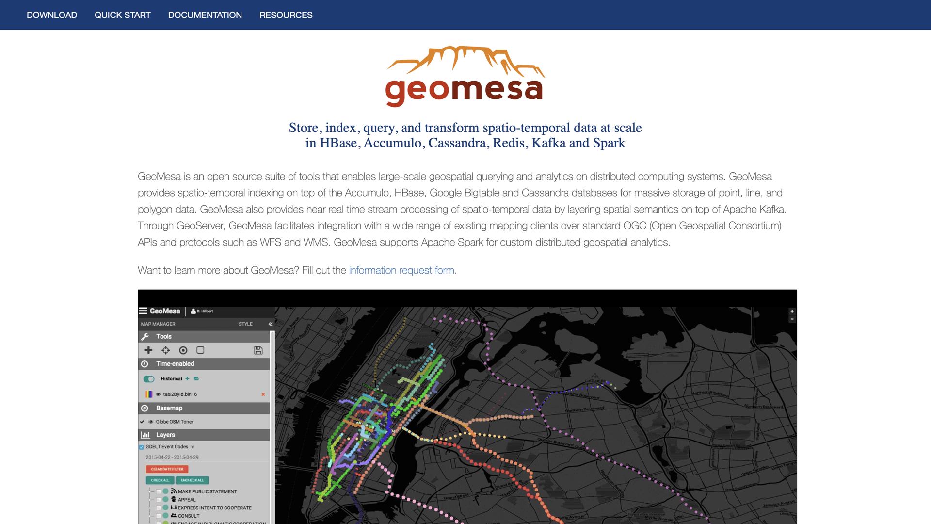
How GeoMesa WorksGeoMesa integrates with distributed data storage systems to offer scalable geospatial data management. Key features include:
- Spatio-Temporal Indexing: Utilizes advanced indexing techniques to handle point, line, and polygon data efficiently. :contentReference[oaicite:1]{index=1}
- Stream Processing: Provides near real-time processing of geospatial data streams by layering spatial semantics on top of Apache Kafka. :contentReference[oaicite:2]{index=2}
- Integration with Geospatial Tools: Works seamlessly with GeoServer, supporting standard Open Geospatial Consortium (OGC) APIs and protocols like WFS and WMS for mapping and data access. :contentReference[oaicite:3]{index=3}
- Distributed Analytics Support: Leverages Apache Spark for custom distributed geospatial analytics, enabling complex data processing tasks. :contentReference[oaicite:4]{index=4}
GeoMesa offers several advantages for managing and analyzing large-scale geospatial data:
- Scalability: Designed to handle vast amounts of geospatial data across distributed systems, ensuring performance as data volumes grow. :contentReference[oaicite:5]{index=5}
- Real-Time Processing: Capable of processing streaming geospatial data in near real-time, supporting timely decision-making. :contentReference[oaicite:6]{index=6}
- Integration Flexibility: Compatible with various data storage and processing platforms, allowing for flexible deployment options. :contentReference[oaicite:7]{index=7}
- Community Support: Backed by an active open-source community, providing continuous improvements and a wealth of resources. :contentReference[oaicite:8]{index=8}
GeoMesa's platform includes several notable features:
- Big Data Persistence: Supports storage backends like Accumulo, HBase, Cassandra, Google Cloud Bigtable, and filesystem datastores for flexible data management. :contentReference[oaicite:9]{index=9}
- Streaming Data Support: Integrates with Kafka and Camel for efficient streaming data ingestion and processing. :contentReference[oaicite:10]{index=10}
- Distributed Geospatial Analysis: Leverages Spark and MapReduce for scalable geospatial data analysis. :contentReference[oaicite:11]{index=11}
- Standard Compliance: Implements OGC standards such as GeoJSON, WFS, WMS, and WPS, ensuring interoperability with various geospatial tools. :contentReference[oaicite:12]{index=12}
GeoMesa is suitable for organizations and industries dealing with large-scale geospatial data, including:
- Telecommunications: Managing network data and optimizing service delivery based on geospatial analytics.
- Transportation and Logistics: Analyzing vehicle tracking and route optimization using geospatial data processing.
- Environmental Monitoring: Processing sensor data for environmental observations and analysis.
- Government Agencies: Handling geospatial data for urban planning, disaster response, and public services.
By providing scalable storage, real-time processing, and advanced analytics capabilities, GeoMesa transforms how organizations manage and analyze geospatial data. Its integration with distributed systems ensures that users can handle large datasets efficiently, while its compliance with OGC standards facilitates interoperability with existing geospatial tools and workflows. :contentReference[oaicite:13]{index=13}
ConclusionGeoMesa offers a robust solution for organizations seeking to manage and analyze large-scale geospatial data. Its open-source nature, combined with powerful features and a supportive community, makes it a valuable tool for leveraging geospatial data to drive insights and informed decision-making. :contentReference[oaicite:14]{index=14}